River Ice – General Information
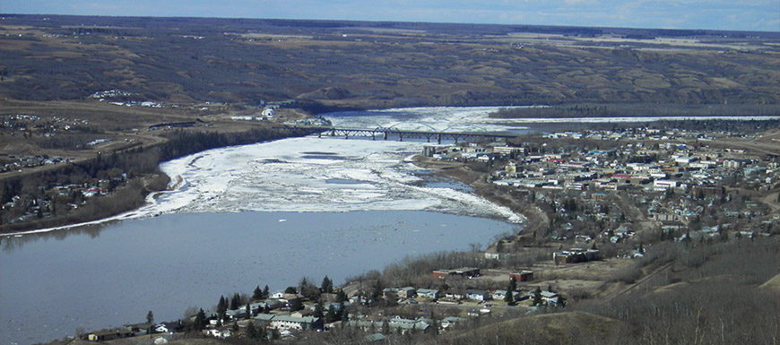
Each year the Peace River freezes over through the Town of Peace River. Generally, it freezes and thaws with little impact on life in Town. It is important for residents to be aware of the freeze and thaw process.
Sometimes due to weather, freeze up or break up does not go smoothly. This can cause river levels to rise and increase the potential of a flood or groundwater seepage. The river is regularly monitored. The Town of Peace River works closely with the Province of Alberta’s River Forecast Centre and through a committee of stakeholders, that includes the Province of British Columbia and BC Hydro.
Staying Informed
The Town keeps residents informed with accurate information and efficient communication during freeze up and break up processes. During freeze up and break up the Town will post any relevant notices on our website, social media pages, and Voyent Alert system.
Signup information for the Voyent Alert system is linked below, as are the social media channels we would use to share updates.
River Freeze Up
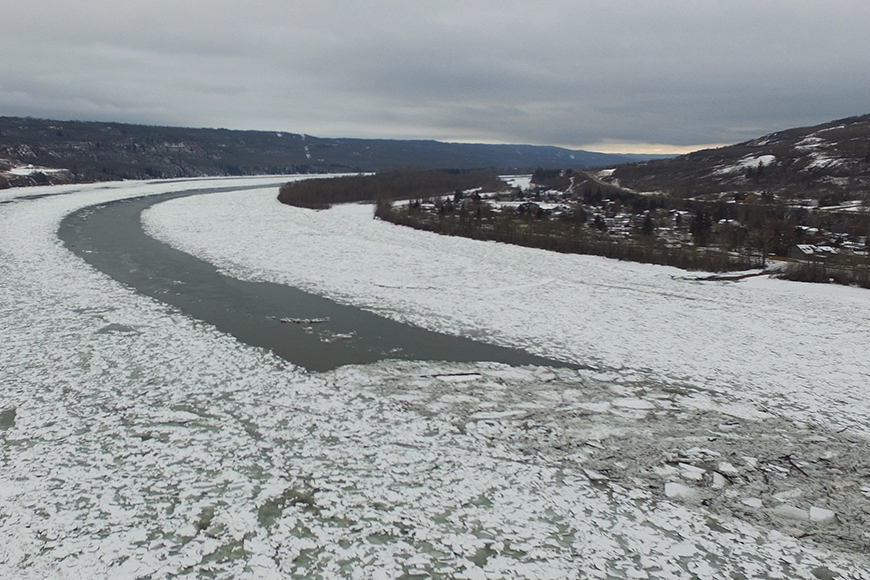
Freeze Up of the Peace River at the Town of Peace River typically takes place in mid-January. It begins when sustained cold temperatures cause ice to form. That ice flows downstream until it fills the river. The ice plus the cold water causes the water to slow and ice to continue to build. That process continues until the river is completely frozen.
The Town of Peace River begins monitoring ice reports and weather patterns in December. When the leading edge of the ice pack, called the ice front, is within 30km of the Town of Peace River our Public Works crew begins Ice Watch. Ice Watch is a way the Town supports the forecasting provided by the Province. Ice Watch provides a visual confirmation of the status of the ice pack and the security of the Town’s anti-flood measures.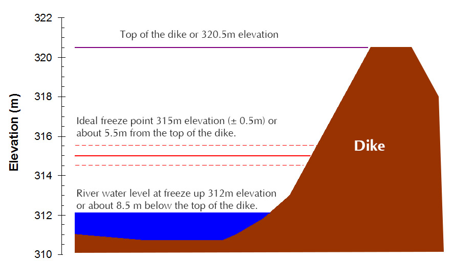 In advance of the river freezing up through Town, BC Hydro regulates the flow coming out of the W.A.C. Bennett Dam. It takes just less than two days for the changes to impact our community. The regulated flow helps to bring the water level down to 312 metres elevation or about eight and a half metres below the top of our dike system. By lowering the levels to 312 metres elevation, the river will freeze at around 315 metres elevation or about five and a half metres below the top of the dikes.
River Break Up
What freezes must thaw. Each year, typically around April, the Peace River thaws at the Town of Peace River. The process is the same as freeze up, only in reverse. During the break up process the Town monitors the Peace River, as well as the Smoky River, Heart River and Pat’s Creek.
Risks
Unstable Ice
If there is ice on the river, stay off it. Each year emergency workers get called to respond to reports of people on or near the ice flows, these are very dangerous situations that put both the person on the ice and the first responders at risk. Our fire department trains for ice rescues, but they’re skills we would rather not need to use. There is no reason to be on the ice during freeze-up and so we ask for everyone’s safety and security that people refrain from going on or near it.
Groundwater Seepage
In the Lower West Peace neighbourhood a number of homes are built with basements below the level of the riverbed. In the past this has presented a challenge for homeowners during freeze-up and particularly breakup with occasional groundwater seeping into foundations and basements. In 2016 BC Hydro completed a dewatering system in Lower West Peace that greatly reduces this risk. When water begins seeping a number of underground wells and pumps kick into action which draw the water into the wells before pumping it into the river, keeping it away from basements.
Flooding
There is always a risk of flooding when the river begins to change. This process is heavily monitored by the Town and Province to ensure residents are kept up-to-date on any potential flood risks. If the water does rise within three and a half metres of the top of the dike the Town of Peace River will issue a green alert to warn residents to take necessary precautions. If an alert is issued info will be prominently posted on the Town’s website and social media pages, and local media.
For more info on Town emergency procedures, alerts and how to be prepared in the event of an emergency please visit our emergency preparedness page.
Government of Alberta
Through the River Forecast Centre the Province of Alberta monitors all rivers, flow and ice pack. This information is available at rivers.alberta.ca. There is also an app available by searching “Alberta Rivers” in either the Apple iTunes store or the Google Play Store that contains the same information.
Information about the River Forecast Centre can be found here: Alberta’s River Forecast Centre Fact Sheet: Awareness and Communication
Please note: while forecasting is based in science, it involves making predictions with a number of unknown or estimated values, for that reason the Town of Peace River and Government of Alberta view seven days as the upper limit for accurate river forecasting. Services like the data available at rivers.alberta.ca or through the rivers app provides excellent insight into the river’s current state, however, the instruments are susceptible to error from time to time.